Blog RSS Feed

Archive for the ‘Geo’ Category

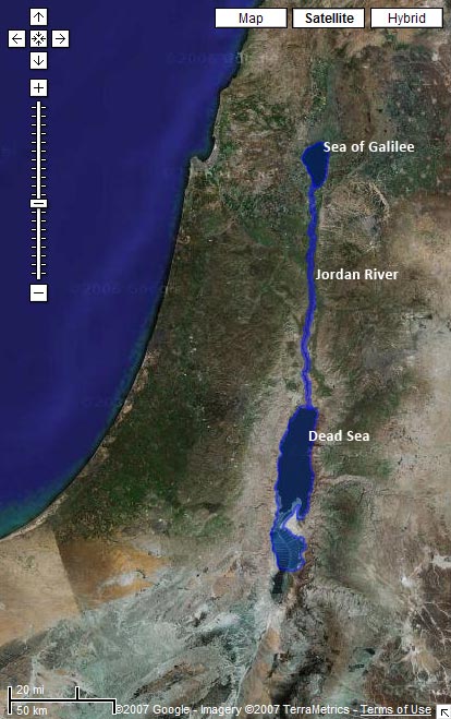
New KML: Biblical Water Bodies

Monday, April 2nd, 2007

Download a KML with shapes for the Sea of Galilee, the Jordan River, and the Salt (Dead) Sea.

Preview it in Google Maps:

Satellite image from Google Maps with the Sea of Galilee, Jordan River, and Dead Sea highlighted

Limitations

The problem with water data is that water levels and paths fluctuate over time. The path in the KML for the Jordan River matches the current satellite data in Google Earth precisely, for example. But the river will change locations the next time Google updates its satellite imagery. And then I’ll either have to update the path to match the new imagery or live with the discrepancy. Of course, the current path of the Jordan only approximates the path it took in biblical times. So even if I update the file whenever Google gets new data, it still won’t accurately represent the historical context (which is impossible to reconstruct).

Even worse is the Dead Sea, which has dramatically shrunk over the past century as more fresh water gets diverted for human consumption. I tried to reconstruct the boundaries of the Dead Sea as it existed during the Bible, but the result is a disconnect between the satellite imagery and the shape file.

How I Made It

I made these outlines by tracing the satellite imagery in Google Earth using the Path and Polygon tools. It’s time-consuming, but you end up with a nice, accurate result. I’m surprised that no one’s done it before for some of these water bodies—at least, not that I could find.

Future Directions

I haven’t yet integrated the data with the rest of the KMLs because I’m not sure the best way to go about it. The main problem is that Google Earth doesn’t let you directly label a polygon or a path on the map. So while you can see the outline for the Sea of Galilee, you can’t know that that’s what it is. People often get around this limitation by creating a placemark inside a shape; I may end up doing that.

I hope to trace more bodies of water over time; I’ll be sure to blog about it when I do. This file represents my first attempts at creating polygons and paths in Google Earth. I wanted to try out some of the features I haven’t used yet. Reducing places to points on a map doesn’t always isn’t always the best way to represent them—some places cover large geographical areas, and shapes are useful in such situations.

New Feature: Jerusalem Map Overlays

Wednesday, March 28th, 2007

Download a KML for Google Earth containing map overlays for Jerusalem, both ancient and modern.

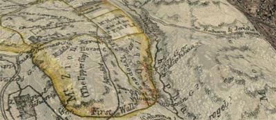
A partially transparent printed map overlays Jerusalem in Google Earth.

Don’t forget to adjust the transparency of the maps and turn on the Google Earth terrain layer to get a strong sense of the topography.

Twelve maps are there now—six of ancient Jerusalem and six of modern Jerusalem. They’re of varying accuracy, especially the ones of ancient Jerusalem.

All the maps come from the David Rumsey Historical Map Collection, an amazing website with thousands of maps, all available under a Creative Commons license, though a slightly different flavor from the one on the rest of this site. Please observe the licensing restrictions for the map images.

More overlays may be on the way from other sources depending on whether I can get permission from the copyright holders to use them. I have to say that I’m a big fan of Creative Commons.

I first heard about David Rumsey from O’Reilly Radar.

Google Lit Trips

Tuesday, March 27th, 2007

My brother points me to GoogleLitTrips.com, a site with a similar mission to this one, except they map the places in classic works of literature instead of the Bible. They’ve done six books so far.

The most visually satisfying of the KMLs, in my opinion, is the one mapping the trip from Oklahoma to California for The Grapes of Wrath:

A Google Earth screenshot shows the Joads’ trip.

Click “9-12” in the banner at the top of the site to get to the list of books. (It took me awhile to figure it out.) Why couldn’t we have had Google Earth when I was an English major?

Complete-Bible KMZ Arranged by Book

Monday, March 26th, 2007

Commenter Josh asks for full-Bible KMZs with books as subfolders. Well, Josh, you clearly like to toggle things, and I’m only too happy to feed your habit.

Download a KMZ arranged by book or by chapter.

Here’s what your sidebar will look like when you’ve finished downloading the books file and Google Earth opens:

“All Bible Places (Books)” appears in the “Temporary Places” folder.

Click the + sign next to “All Bible Places (Books).” A list of books appears:

Each book is a folder.

Click the checkbox next to each book you want to look at—any number of books is fine, though you’ll start getting duplicates if you look at more than one book at a time. In other words, there will be two Jerusalems if you look at both Matthew and Mark.

The chapter KMZ is arranged by book, then by chapter.

New Feature: Bible Atlas

Saturday, March 24th, 2007

All the places in the Bible in one place, arranged alphabetically, with thumbnails and links to all their occurrences.

How to Add KMLs to Google Earth

Friday, March 23rd, 2007

In response to an earlier post, David asks the good question of how to add the files to Google Earth. It’s actually pretty easy.

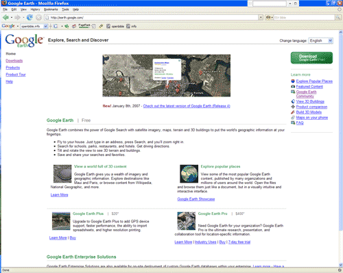
1. Download Google Earth if you don’t already have it installed. It’s free, and it’s useful for all sorts of things if you (or your kids) like maps at all.

Google Earth homepage.

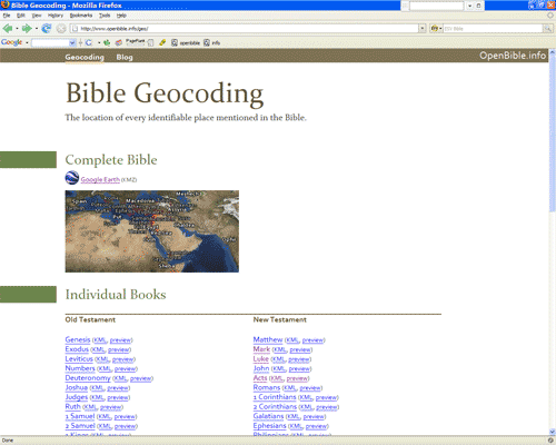
2. Go to the Geocoding page and click the KML or KMZ file you want. I’ll assume you want the file with all the places in the Bible.

The Geocoding page on OpenBible.info

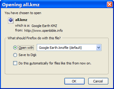
3. A popup window appears similar to the one below. Open the file directly with Google Earth. (Alternately, you can download the file somewhere, such as your Desktop, and open it there.)

Firefox or another browser prompts you to open or download the file. Open it.

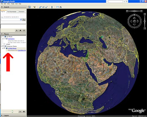
4. Google Earth opens. “All Bible Places” appears under the “Temporary Places” folder in the sidebar.

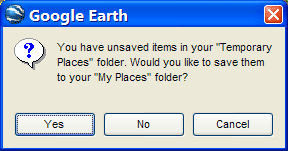
5.Now use Google Earth however you want to. When you’re done, close Google Earth to get the following prompt. Click “Yes” if you want to save the places permanently to your computer.

You have unsaved items in your “Temporary Places” folder. Would you like to save them to your “My Places” folder?

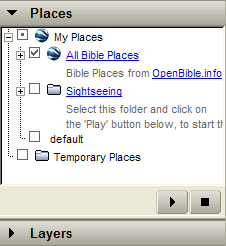
Now the places will appear whenever you start Google Earth. Check or uncheck the checkbox to make them appear or disappear.

“All Bible Places” appears under “My Places” in the sidebar.

I hope that was clear enough. Leave a comment if you run into any problems.

Incoming Links

Thursday, March 22nd, 2007

The ESV Blog linked to OpenBible.info today, sending lots of traffic.

Buzzard Blog also linked, saying, “Um, this is amazing. Some folks at OpenBible.info have used Google Earth to ‘geocode’ the Bible–to satellite map every book of the Bible, noting each location mentioned in Scripture.” Thanks! I really appreciate it.

Mobile Ministry Magazine linked, saying, in part, “But some of you are like ‘cool’ and others are like ‘so what.’ Here’s the answer to the ‘so what’ part: you can tell someone how far your church is from where Solomon built the temple; you can tell your kids to walk on water and actually give them a distance of how far that was; or, various other things you can point out being that now you can give a real world place to the places that in some respects no longer exist, or exist in the same way they did when parts of the Bible was written.”

Solomon built the temple in Jerusalem, of course. And scholars dispute exactly where Jesus was walking on water. Luke mentions that it was near Bethsaida, but Mark says that the boat was going to Bethsaida. Some people have suggested that there were two Bethsaidas, while more recent thinking argues that “Bethsaida” also means “the area around Bethsaida.” I followed the latter thinking. In any case, John mentions that they ended up in Capernaum on the north side of the Sea of Galilee.

Ray Fowler shares:

Have you ever come across a place name while reading your Bible and wondered where it is? OpenBible.info has plotted the locations of every identifiable place mentioned in the Bible and coordinated the information with Google Earth to give you satellite images of Bible place names sorted by book and chapter. The process is called Bible Geocoding. This could be a helpful site to have open while reading or studying a particular book of the Bible to keep track of what place is where.

That’s definitely one use for the site (thus all the pretty maps). I also hope that other people will take the raw data and build much cooler things with it than I’m capable of.

Uber-blogger Justin Taylor also generously provided a link.

Free in Truth reposted some of the ESV Blog’s post. I’m glad you found it interesting!

Executable Preacher writes: “What the creator of Bible Geocoding has done is to associate the location of every identifiable place mentioned in the Bible onto Google Earth maps. He has done this for every book of the Bible with the exception of those books that list no place names. Check it out for yourself, a great deal of time and effort has been put into this!”

It took about a month of work in my (apparently copious) spare time, from identifying the places to doing the programming for the maps, to create this site. Executable Preacher also links to BibleCharts.org, which looks like it has some useful info.

Patrick Lacson says:

Tired of looking at the maps on the back of your bible? Want something more interactive? The folks at OpenBible.info have “geocoded” all the places in the Bible, that is to say they’ve pinpointed the geographical location (longitude/lattitude) of every identifiable place mentioned in the Bible.

My disappointment with the current state-of-the-art of Bible mapping was one of the impetuses behind the site. On the other hand, both BibleMap.org and BibleMapper.com do high-quality work.

Robbro.com writes: “This is one I’ve been looking for… A Google Earth KMZ file for the Complete Bible, or broken down by Individual Books.” Glad to oblige.

Because I Said So was nice enough to feed the site a link.

Religione 2.0 says something in a language (Italian) I don’t speak, though my high-school French plus a Google translation makes me think that, at least, they’re not angry with me.

Phil Gons writes: “I love being able to see the places about which I’m reading, and being able to zoom in and interact with them in a 3D environment beats a 2D map or image as far as I’m concerned, though being able to preview and link to these locations in Google Maps is still pretty cool.” Surprisingly, Google Maps gives a good approximation of the Google Earth experience. The only limitation I’ve run into is that it can’t show a big number of places at once, so larger books don’t show up in their entirety.

Sunday School Thoughts says: “This is very cool. It is a google map of every location mentioned in the Bible. You can look at the locations of each city mentioned in each Book of the Bible. Just click the preview button next to a book and try it out. It is much more powerful than that, if you have Google Earth installed (I don’t).” Brett left the very first comment on this blog below.

Power of Change writes: “Fun map clicking lies ahead…” Map clicking is strangely compelling. I’m not sure why that is.

Blogging with Pastor Brian quotes the Executable Pastor post, adding rhetorically (I hope it’s rhetorical, anyway): “How cool is this?”

w2wkb’s Bog Splot provides a link, too.
Plotting Bible Places over Time

Tuesday, March 20th, 2007

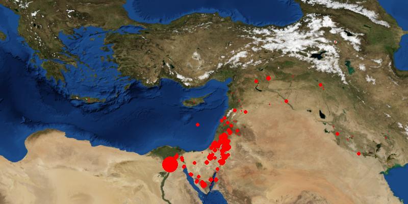
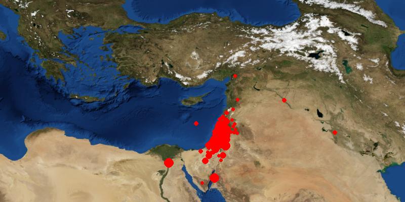
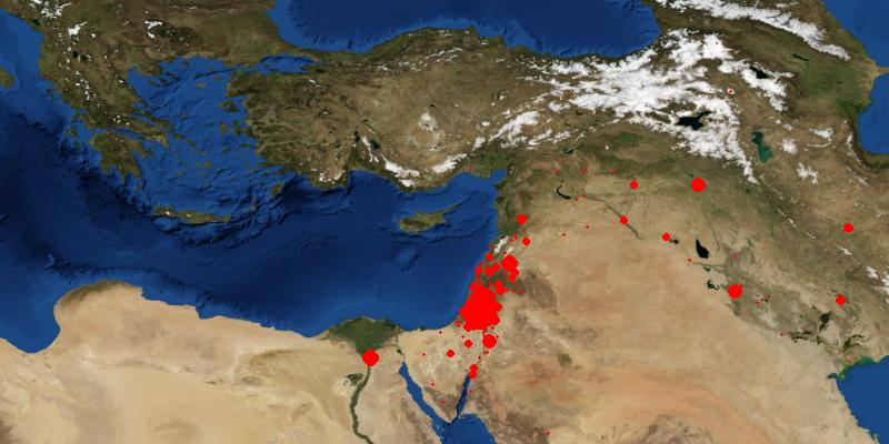
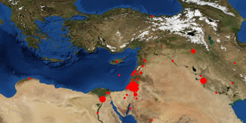
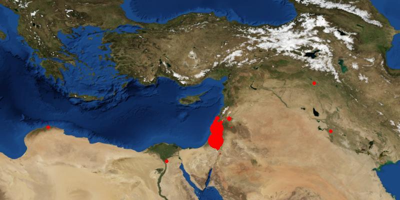
A recent post on the Inside Google Book Search blog plots the locations mentioned in books over time. Let’s do the same thing with the Bible geocoding data. Bible book order corresponds (very) roughly to historical order, so I’ll use books as an approximation for historical periods. The bigger the dot, the more often the books mention the place.

Genesis to Deuteronomy

Here you can trace the patriarchs’ and the Israelites’ journeys to lots of places that aren’t the promised land.

Joshua to Ruth

The conquest and early rule of Canaan.

1 Samuel to Esther

The rule of the kings and subsequent exile.

Job to Malachi

These books cover a good period of time, much of it preoccupied with the exile.

Matthew to John

The gospels focus on the life of Jesus in Palestine.

Acts to Revelation

The church spreads beyond the Middle East.

Whole Bible

Here it’s all put together.