AI-Generated Maps of the Holy Land

These images were generated by GPT-4o, an AI that converts text to images. Hover your mouse over the image to see the prompt that generated it, and click to see a full-size version. Since these maps are AI-generated, their topography doesn't exactly match reality; in particular, many of these maps include a river connecting the Dead Sea and the Red Sea. This river doesn’t exist. You’ll also note that the Sea of Galilee doesn’t always appear. These images are available under a CC-BY license, so please feel free to use them for whatever purpose you like. Blog post about this page.

 A map divided into a strict invisible modular grid — each grid zone using minimal color and texture to show dominant landcover — desert, scrubland, forest, hills, etc. — while flowing naturally across boundaries.
Modular Grid Landcover Map
 A map where contour lines are impossibly fine and faint — almost like whispers on paper — building gentle hills and river valleys through sheer accumulation of airy traces.
Whisperline Contour Map
 A map where contour lines are drawn like taut, stretched threads — flowing organically, layering on top of each other — giving the whole terrain a woven, tensile, alive feeling.
Topographic String Map
 A stylized ink-and-wash terrain map — fine black ink outlines the major forms, but wild, vibrant splashes of watercolor (turquoise, gold, crimson) flow across the land, hinting at climate and vegetation zones.
Modern Ink Wash with Color Splashes
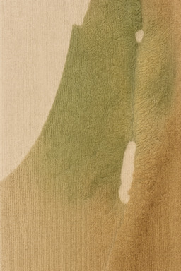
 A soft, abstract watercolor rendering of ancient Israel’s landforms. Gentle blends of earth tones and blues, subtle texture, no hard edges. Looks like a map bled into parchment with a brush.
Watercolor Map
 A 3D isometric miniature of ancient Israel, where the land looks like it’s carved from clay or foam, hand-painted textures, and tiny realistic trees along ridgelines. Slight depth of field for a "real model" feel.
Miniature Diorama Map
 A terrain map with a soft parchment background, realistic shading for hills and valleys, and faint brown contour lines. Feels ancient and worn but finely detailed and usable. Use naturalistic colors to indicate land cover.
Parchment-Lit Shaded Map
 A matte, smooth map where hills rise like gentle silicone ridges, rivers groove through buttery surfaces — squishy but structured — a playful, sensory reimagining of the land.
Soft Silicone Landform Map
 A dynamic, flowing map where hills and rivers swarm like birds in murmuration patterns — terrain bending and moving in soft rhythmic formations, loosely flowing but grounded.
Murmuration Land Map
 A terrain map where tiny, tight dots form mountains, rivers, and valleys — dense dots for ridges, lighter dot fields for plains — using carefully chosen earthy tones (sands, greens, muted blues) to model the land naturally.
Classic Fine-Dot Terrain Map
 A cinematic close-focus render where foreground mountains are sharply detailed and background terrain melts into a soft blur — valleys glowing, rivers glinting, a sense of vastness but intimacy.
Shallow Depth of Field Ridge Map
 A clean modern map that looks like a conservation area guide — natural earth tones, simple but elegant terrain shading, major geographic features emphasized, minimal visual noise.
Conservation Area Poster Map
 A clear, grounded map — precise, earthy, rugged — focusing on the unvarnished physical realities of the terrain. Rivers muddy and meandering, hills softly rolling or starkly dry, rendered with honest texture and muted natural colors.
Realism Landform Map
 A map where elevation is shown with clean bands of color that fade smoothly — desert sands into orange, rocky hills into olive green, highlands into dark blue-purple — stylish, modern, and full of life.
Topographic Bands with Saturated Fade
 A map where wax is applied before paint to protect river valleys and coasts — waxed areas stay bright, while the land darkens and roughens — rivers gleaming clean through wild textured uplands.
Wax-Resist Valley Map
 A detailed and accurate map in the style of early Renaissance explorers—hand-painted hills and rivers with delicate brushwork, soft earthy tones, slightly imperfect ink lines, and aged naturalistic shading.
Hand-Painted Renaissance Cartography
 A map that looks almost flat at first glance, but on close inspection has an ultra-fine texture (like paper grain or noise) suggesting subtle elevation changes — extremely light-touch, nonintrusive under data.
Microtextured Minimal Terrain Map
 A bold, bright pop-art styled map — thick black outlines, explosive flat color zones — valleys in vivid lime, mountains in rich magenta, rivers in electric blue — hyper-energetic but simple shapes based on real terrain.
Pop Art Poster Terrain Map
 A bright, almost storybook-like topographic map where mountains, deserts, and seas are oversized and soft — like a dreamland — but the geography is still essentially accurate.
Magic-Land Style Topography Map
 A density-focused map where deep green shows thick vegetation (e.g., Jordan Valley), fading to ochre in semi-arid lands, and pale tan in deserts — an intuitive "lushness" map.
Vegetation Density Heatmap
 A layered, prismatic design where zones of different ecological life shimmer and fracture into multicolored fields — lush patches, arid stretches, and water-fed regions each refracting color differently.
Prismatic Ecosystem Fields Map
 A sleek, metallic-toned map drawn in graphite — ultra-fine shimmering lines tracing valleys and ridges — giving the land a subtle, almost mechanical precision with a hand-drawn soul.
Graphite Topography Sketch Map
 A map where every mountain ridge is a sharp origami crease, valleys unfold like open pages — the whole terrain built from crisp, angular paper folds, creating a dynamic, sculpted landscape.
Paperfold Ridge Map
 A soft, dreamlike map where rivers and coasts bleed slightly outward like ink dropped on wet paper. Subtle, flowing edges that feel natural and organic, yet map-accurate.
Pastel Ink Bleed Map
 A hybrid historic landcover map showing plausible zones of ancient agriculture, pastureland, wild forest, and desert — overlaid softly on the topography. Earthy, faded tones evoking ancient human shaping of the land.
Ancient Land Usage Map
 A clean isometric terrain map like the overworld of a grand strategy videogame — soft lighting, smooth gradient mountains, muted realistic color palette, coastline sparkles subtly.
Strategy Game Overworld Map
 A simulated tilt-shift photo of ancient Israel's terrain—realistic shading but with exaggerated blur at the top and bottom edges, making the map feel like a tiny living model world.
Tilt-Shift Terrain World
 A map in powerful monochrome (dark grays and bright lights) — mountains dark and jagged, valleys bright and clean — bold energy without any color at all.
Bold Monochrome Terrain Punch Map
 A terrain map tinted with silvery highlights, like a brushed metal engraving. Rivers and coastlines gleam slightly; hills cast smooth, dark shadows. Sharp, clean, futuristic but traditional. Use appropriate coloring for a naturalistic feel.
Silver-Tone Map
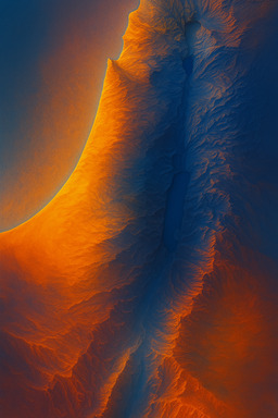
 A light-focused map where hills catch faint horizon glows, valleys sink into cooling shades, coastlines shimmer like distant mirages — geography built from gradients of luminosity rather than drawn elevation.
Horizon Glow Terrain Map
 A dramatic high-contrast map made on black scratchboard — white lines scratched out to reveal coastlines, rivers, and mountain silhouettes glowing against dark emptiness.
Scratchboard Terrain Map
 A minimalist map where contour lines glow faintly in neon tones — electric blue for rivers, hot pink for hills, lime green for valleys — set against a dark or muted background. Clean but electric.
Retro Futurist Topographic Lines
 A map drawn entirely in crisp, fine ink lines — coastlines and rivers traced with hand-drawn elegance, terrain suggested by delicate hatching — giving the feel of old copperplate prints without visual clutter.
Antique Ink Line Terrain Map
 A flat geometric map where rivers, plains, and mountains are divided into bold "panes" of soft translucent color, like an abstract stained glass window of the land.
Minimalist Stained Glass Map
 A finely structured map where terrain is rendered with sharp, high-fidelity detail — hills and rivers modeled almost like sculptures, organized cleanly within a perfectly composed layout — emphasizing classical ideals of balance and proportion.
Academic Classicist Map
 A map where the mountains, valleys, and rivers of ancient Israel are sculpted almost photographically — extreme attention to light, shadow, surface textures like rock, sand, and soil. Feels tangible, touchable.
Hyperrealistic Terrain Sculpt Map
 A map where coastlines, rivers, and mountain ridges are softly sketched in colored chalk — dusty textures blending at the edges, faint smudges suggesting valleys and plains — bright, rough, and fleeting.
Chalk Dust Terrain Map
 A formal terrain map using slightly stylized pictorial shading — mountains with soft painted textures, valleys and plains clearly distinct, sea areas subtly textured with wave patterns.
Pictorial Terrain Guide Map
 A map where terrain edges (coastlines, valley rims, desert margins) are softly tinted in color blushes — like delicate pastel smudges — creating a soft luminous structure across the otherwise clean landmass.
Edge Blush Map
 A single unbroken black line flows across the whole map, spiraling and folding to sketch out the terrain. Elegant, abstract, but still clearly showing mountains, rivers, and coastline shapes.
Monoline Terrain Flow
 A looser, humanized reinterpretation — classic Swiss contour logic, but with slightly imperfect hand-drawn ink lines, and gentle ink washes filling valleys — making it feel alive, not mechanical.
Hand-Drawn Swiss-Style Map with Ink Wash
 A map where hills, valleys, and rivers are carved into warm-toned wood — soft burnished highlights over mountains, riverbeds gouged gently into the grain — earthy, textured, permanent.
Carved Wood Relief Map
 A pure, traditional Swiss-style shaded relief map of ancient Israel — delicate shading for terrain, clean coastline, classic colors, masterful light sourcing.
Classic Swiss-Style Shaded Relief Map
 A restrained 3D render using muted earth tones — olive greens, warm browns, pale sands — precise ridges and valleys shaped by light and shadow rather than intense color — subtle and sophisticated.
Minimalistic Earth Tone Terrain
 A visual map that looks like it’s stitched with thread — brown stitches for mountains, blue embroidery for rivers, golden thread for desert sands — tactile and handcrafted but precise.
Embroidered Map
 A modern map using ultra-subtle real earth textures (grains, sands, stones) to distinguish different terrain zones. Lightly tinted zones blend softly without lines—terrain through pure materiality.
Earth Texture Minimalist Map
 A futuristic wireframe map of ancient Israel — like a 3D modeling view — with elevation lines forming a geometric net across the land. Sharp, angular, hyper-modern but map-true.
Digital Wireframe Terrain
 A terrain map built from tiny hand-cut stones — rough desert patches in warm ochre pebbles, riverbeds in glassy blues, mountains in rugged black — shimmering with uneven ancient energy.
Stone Mosaic Terrain Map
 A mini-isometric world where mountains, rivers, and other features are shown in playful 3D — like a diorama for toy explorers — terrain exaggerated but laid out accurately.
Tiny Adventurer Isometric Map
 A collage-style map where different terrain types are represented with slightly different paper textures and subtle torn edges, pieced together into the shape of ancient Israel. Elegant, layered, tactile.
Fragmented Landform Collage
 A map where the land seems brushed onto the surface with the lightest feather touch — rivers hinted by faint wet glimmers, mountains barely a lift in the surface texture.
Feather-Touch Terrain Map
 A rich, ornate map where every feature — rivers, valleys, mountains — is rendered with jewel-toned clarity and medieval-inspired beauty, alive with fine detail and mythic overtones. Decorative borders echo floral motifs.
Pre-Raphaelite Garden Map
 A map where rivers, deserts, hills, and other landforms are rendered using bold, vibrating fields of complementary colored dots — ochre and blue deserts, green and magenta valleys — creating shimmering, energized landscapes.
Vibrant Colorfield Dot Map
 Isometric view of a satellite view of the geography and landcover of all of Israel. Don't include any human features like roads, cities, or agriculture. Just show the natural landscape. Make the colors look like a realistic satellite photo, but also make it look like a videogame isometric style. Don't go for too much detail.
Isometric Satellite View
 A terrain map set on deeply textured, aged parchment — coastlines softly cracking, mountain ranges drawn with faded, rough ink strokes, rivers winding like ancient veins across the weathered surface.
Parchment-Textured Relic Map
 A dynamic, algorithmically-inspired map where landforms are outlined with fluid, wave-like mesh structures — rivers and ridges flowing along delicate, mathematical paths in luminous color fields.
Parametric Mesh Terrain Map
 A clear, grounded map — precise, earthy, rugged — focusing on the unvarnished physical realities of the terrain. Rivers muddy and meandering, hills softly rolling or starkly dry, rendered with honest texture and muted natural colors.
Realism Landform Map
 A terrain map with no color or lines — only shadows and highlights revealing the landforms. Almost like sunlight raking across a 3D model of the terrain. Minimal yet deeply dimensional. Bodies of water should be visible.
Shadow-Only Elevation Map
 A purely tactile map — no ink at all — where terrain is pressed and embossed into thick vellum — valleys sunken, mountains raised — land visible only through shadow and touch. The map is dramatically lit to show the shadows.
Embossed Relief Map
 A brutal, expressive map where thick, sandy paint is dragged roughly across the canvas — ridges tearing upward, valleys scraped into wide broken flows — the land as a record of struggle.
Grit and Drag Terrain Map
 A map built from just a few sharply defined black-and-white shapes — coastlines crisp, river valleys thin cuts through wide open fields — stark, commanding, high-impact.
Monochrome Shape Block Map
 A terrain map where landforms are created through layers of transparent watercolor washes — mountains rising through saturated folds, rivers carved by pale bleeding flows — airy but detailed.
Watercolor Breath Landscape Map
 A classic nautical chart version of ancient Israel: delicate hatch shading for elevation, wave patterns for the sea. Traditional ink drawing with beige background.
Antique Nautical Chart Style
 A map rendered like layers of cut paper or topographic relief sculpture. Soft shadows, pastel tones, clean edge separations for hills, valleys, sea, and plains. No borders or labels—just the layered land itself.
Layered Papercut Map
 A sleek modern map where mountains are shaded minimally, rivers are precise thin lines, land elevation is shown with a soft continuous color ramp (no heavy contour lines). Calm, refined, readable.
Minimal Modern Physical Map
 A stark black-and-white relief map — no unnecessary shading — just sharply rendered valleys and ridges, relying on shadow play for topographic depth. Looks like a high-end art print more than a traditional map. Use color sparingly to indicate water. Add additional naturalistic color.
High-Contrast Relief Map
 A naturalistic map where features are picked out with a thin layer of shimmering gold leaf texture. Elegant, maximalist, and a little over-the-top, but still recognizable as a map.
Maximal Gold Leaf Highlight Map
 A terrain map where base features are drawn cleanly in ink, then hand-tinted with washes of watercolor (earth greens, pale blues, sandy golds) — land gently glowing with soft vintage life.
Hand-Tinted Lithograph Style Map
 A softer, airier map: larger, less rigid dots loosely scattering across the land — heavier along mountain ranges, lighter across river plains — evoking a dreamlike, breathing terrain.
Loose-Brush Dot Impression Map
 A map that traces how the land feels under the sun and wind — hot exposed hills, cool shaded valleys, breezy plains — the experience of movement, shade, and climate shaping the land’s meaning.
Sun and Wind Path Map
 A clean, minimalist topographic map of ancient Israel in tan sand tones and black ink lines. No labels—just contours, coastlines, and subtle elevation shifts. Evokes the serenity and mystery of ancient landscapes.
Minimalist Topographic Map
 A map where terrain is suggested by the wrinkles, folds, and shadows of crumpled color paper that reflects the landcover—abstract but readable, rugged and raw.
Crumpled Paper Terrain
 A dynamic map where dense cross-hatched brushstrokes — almost like woven fibers — build up mountains and hills, with softer open fields for valleys and river basins.
Thick Brush Weave Map
 Soft, beautiful terrain shading showing mountains, hills, and valleys, with ultra-clean rivers, lakes, and coastlines drawn in slightly darker crisp lines — elegant structure, maximum clarity.
Fine Shaded Relief with Clean Hydrography Map
 A painterly map of ancient Israel with loose impressionist brushstrokes—coastlines slightly softened, hills suggested with light and color, not hard lines. Luminous and organic but recognizable as a map.
Impressionist Brushstroke Terrain
 A painterly map where different landcover zones are painted with soft, wide brushstrokes — deserts rough and dry-textured, riverlands smooth and lush — impressionistic but clear. Don't include any topography or shading — only landcover and water.
Brushstroke Biome Map
 A loose, impressionistic landscape where terrain forms are recognizable but rendered with lush, thick strokes of color — brushwork that evokes the land’s life and motion rather than drawing every feature precisely.
Painter’s Impression Map
 A map drawn like an 18th-century scientific engraving—ultra-fine black ink lines forming precise hills and valleys, crosshatching for depth, clear coastline lines. Detailed but clean.
Fine-Line Engraving Style
 A map where the land seems brushed onto the surface with the lightest feather touch — rivers hinted by faint wet glimmers, mountains barely a lift in the surface texture.
Feather-Touch Terrain Map
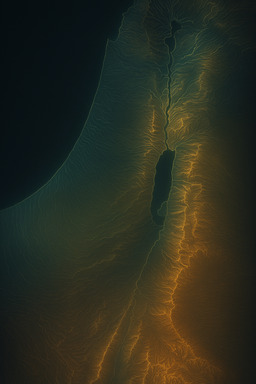
 A terrain map where elevation lines faintly glow against a dark background — each contour illuminated like a heatmap but in elegant golds and teals. Topography pops vividly without losing realism.
Contoured Glow Map
 A map where rivers and mountains are built from thick, heavy paint strokes — palette knife ridges forming mountains, deep brush-grooves cutting river valleys — terrain sculpted in vivid peaks and furrows.
Impasto Relief Map
 A map where the land is abstracted into dynamic tessellated tiles — size and orientation changing based on the "energy" of the land — dense where mountains cluster, sparse and stretched over plains.
Dynamic Tessellation Terrain Map
 There should be no modern features like agriculture, cities, roads, or salt flats around the Dead Sea. Instead, you should show the area as it would have appeared in its natural state thousands of years ago. Don't reproduce the terrain (mountains, valleys, etc.); just reproduce the land cover. The terrain should appear perfectly flat; I'll be adding in terrain shading later. As it goes south, the climate becomes more arid, so the vegetation should be less dense. The browner areas in the drawing should also have much less vegetation.
Peak Vegetation Satellite View
 A terrain map built from thousands of tiny color tiles — deep blues for the sea, earthy reds for hills, soft greens for valleys — shimmering slightly uneven textures, like a living land mosaic.
Byzantine Mosaic Terrain Map
 A soft textural map where a parchment-like warm background hosts thin, flowing valleys and coastlines — a living, quiet surface.
Parchment Wash Horizon Map
 A map where the spines of mountains and hills are feathered with brightness — highlights along ridges — hinting at the land’s rise without shouting it.
Feathered Ridge Highlight Map
 A map created by scattering and brushing loose earth pigments — ochres, rusts, sands — to form flowing land shapes, rivers glinting through the fine powder — evanescent and alive.
Pigment Dust Terrain Map
 A heavily shaded, lush fantasy isometric terrain map — every mountain range casts long painterly shadows, valleys are carved deeply, sea edges glow faintly. Highly dramatic but fully geographic.
Fantasy Isometric Relief Map
 A sharp-lined physical map — coastlines, rivers, ridgelines, — drawn in thin, precise black or dark-gray lines over a light textured background — highly readable, modern, stylish. Use naturalistic land coloring as appropriate.
High-Contrast Terrain Linework Map
 A stylized relief map where the coastline glows faintly against a darker inland terrain. Mountains and valleys are realistically shaded but edges softly blur into the background, creating a dreamlike focus.
Soft-Edge Relief with Coastal Glow
 A pointillist-style modern map where terrain height is represented by the density and size of tiny black dots. Mountains cluster with heavy points, deserts are sparse fields. Minimal yet analytic and artistic.
Data-Driven Elevation Dots
 A map where terrain features are rendered as if carved into ancient, weather-worn stone — deep cracks for valleys, rough surfaces for hills, smooth plates for plains. Naturalistic and rugged.
Eroded Stone Texture Map
 A structured map where thin stacked horizontal bands expand or compress depending on elevation — tighter stacks for mountains, looser spacing for plains — creating visual topography through line density.
Linear Topographic Band Map
 A bright, bold, high-energy map — chunky cartoon mountains, glittering rivers, swirling clouds over the coast — thick outlines, vivid primary colors, dynamic flow, like a classic 90s cartoon backdrop.
Saturday Morning Adventure Map
 A soft, glowing map where rivers shimmer like flowing milk and valleys ripple like golden honey — rich, smooth, abundant textures spreading across fertile plains and soft rolling hills. Be sure to retain the physical features to the extent possible.
Milk and Honey Flow Map
 A map where hilly regions are rough, scraped textures made by dragging thick paint with a knife — chaotic, raw, alive — contrasted with smoother, glossier river valleys.
Palette Knife Hill Map
 A richly colored map where brushstrokes are visible — land textured like oil paint on canvas — but simplified and smooth for animation readability, balancing depth and clarity.
Painterly Adventure Animation Map
 A soft colorfield map where plains, hills, and water are represented by broad, slightly fuzzy fields of color—no hard lines, but landforms emerge naturally from hue transitions. Dreamlike yet geographic.
Colorfield Abstract Landform Map
 A cartoony expressive map where deserts, hills, and rivers are made from playful paint splatters and smudges — vibrant fields, soft landforms emerging naturally from colorful messiness.
Paint-Splatter Map
 A map that looks gently aged by water — soft stain edges at valleys and river mouths — giving the land a sense of long memory without losing clarity or readability.
Waterstained Horizon Map
 A map using wide, flat contour bands — each elevation range a single color band — stacked like cut paper shapes — terrain simplified into horizontal slices of bold tone.
Flat Poster Contour Map
 A map where the land is cracked into abstract prism shards — each terrain type catching and bending color slightly differently — plains gleaming warm, hills refracting cool, rivers slicing sharp.
Shattered Prism Land Map
 A minimalist landform silhouette of ancient Israel using sharp shadow contrast. Stark light source creates a dramatic, black-and-white shadow map showing only hills and valleys as forms. Bold and abstract.
Shadow & Shape Landform Silhouette
 A dry, rugged desert render — cracked earth textures, razor-sharp rocky ridges, bright glare over sand flats — ancient Israel’s deserts rendered with gritty realism and powerful starkness, and the grasslands contrasting with them.
Crisp Dry Desertscape Map
 A scientific-style vintage map with shaded hills and valleys drawn in fine engraved lines — soft hand-hatched shadows — structured but calm, ready for careful overlays.
Early Enlightenment Relief Map
 A grayscale map where ridges and valleys are traced in soft silvery gradients — bright where high, dusky where low — terrain as a shimmer, not a structure.
Silverlight Ridge Map
 A modernist map where terrain is expressed purely by the density and arrangement of tiny dots — more dots for higher elevation, sparse dots for plains, clusters for river valleys — crisp and stylish.
Minimal Dot Matrix Map
 A contemporary art map using only bold, sweeping ink brushstrokes to suggest mountains and rivers. Almost abstract but with enough form to recognize the coastline and major terrain features.
Minimal Ink Brush Map
 A realistic but artistic map that highlights the transition zones — from scorched desert sands, to rocky highlands, to grassy scrubland, to the blue shimmer of the Mediterranean.
Sunscorched Desert-to-Sea Map
 A casual, sketchy map where rivers and mountain ranges are loose hand-drawn squiggles and zigzags — colorful and organic, looking like a vibrant field notebook from a wandering explorer. Use color liberally.
Doodle-Sketch Terrain Map
 A map where mountain ridges build up rough, crusty edges of layered dried paint — highlands literally rising above the smoother lowlands — a dramatic, sculptural surface.
Crusted Edge Highland Map
 A technical masterpiece: terrain drawn like an architectural plan — contour lines in ultra-thin black or navy, rivers shown as fine blue channels, with tiny, perfect crosshatch shading on slopes — evoking maps as art objects.
Architectural Swiss Terrain Blueprint
 A night-sky themed terrain map where rivers and coastlines faintly glow with shifting iridescence against a deep navy landmass. Feels luminous but quiet, blending geography and atmosphere.
Iridescent Night Terrain
 A map drawn like an 18th-century scientific engraving—ultra-fine black ink lines forming precise hills and valleys, crosshatching for depth, clear coastline lines. Detailed but clean.
Fine-Line Engraving Style
 A map merging brutalist starkness (heavy blocks, rigid structure) with a soft color palette — think muted pinks, dusty blues, sandy grays — and hard-edged terrain forms.
Soft Brutalist Terrain Map
 Shading and contour lines follow traditional Swiss style, but major ridges and valleys are emphasized with geometric overlays (triangles, arcs, flow fields) — organic land with an abstract geometric skeleton.
Geometric Shaded Contour Swiss Map
 A wild, stylized 1980s synthwave version — grid-patterned deserts, neon pink coastlines, purple mountains, shimmering electric-blue rivers — ultra-retro-futuristic but map-true underneath.
Neon Synthwave Israel Map
 A deep-etched map where valleys are cut into the surface and inked dark, while ridges and mountains rise as lighter untouched spaces — geography carved into light and darkness.
Intaglio Valley Cut Map
 A surreal, slightly AI-generated look — hills and valleys morph slightly beyond strict realism, feeling half-sketched, half-imagined — colors bloom unpredictably (corals, olives, magentas) in a dreamlike but grounded echo of the real land.
Organic AI-Dream Map
 A map where every landform is exaggerated into soft, springy shapes — mountains puffed up like pillows, river valleys sinking like gentle hammocks — light shadows creating a sense of weightlessness.
Bouncy Topography Map
 A stylized low-polygon map of ancient Israel — mountains and valleys built from sharp triangular facets. Bright light and simple color blocking. Like a clean 3D modeling environment.
Low-Poly Terrain Map
 A fully conceptual map where all terrain features emerge out of a breathing field of dots — mountains forming islands of heavy dots, valleys exhaled in wide sparse fields — pure, sacred, and living.
Sacred Breath Dot Field Map
 A ghostly map where terrain is revealed only through shadows and faint impressions — mountains suggested by dim overcasts, river valleys darkened like old, fading footprints.
Shadow Memory Land Map
 A dazzling map where tiny multi-colored dots (teal, gold, crimson, sapphire) flicker across the land — clustering into recognizable mountains, rivers, and deserts — a landscape built from shimmer rather than blocks.
Prismatic Flicker Terrain Map
 A map where the land isn't drawn directly, but emerges from empty space — rivers and valleys ghost into being where light and color thin out, creating presence through absence.
Negative Space Terrain Drift Map
 A base shaded relief map with a soft overlay showing main ecological zones — fertile valley, desert, semi-arid hills — so natural texture is felt without noise.
Subtle Landcover Overprint Map
 A relief map where the edges of the page and lower elevations gently fade into the background — mountains softly lifting into crisp detail — giving the map a natural breath and focus.
Horizon-Fade Relief Map
 A map where horizontal lines ripple upward gently at mountains and downward in wide arcs at valleys — a constant undulating wavefield of land texture.
Ripple Layer Land Map
 A map where terrain is divided into irregular organic "shards," like cracked glass or dried mud, each filled with a different hue — warm desert colors, cool coastal tones — hinting at surface differences.
Fractured Land Mosaic Map
 A map where mountains and valleys are sharply etched with high-contrast shading — ridges pop forward, valleys plunge back — giving the land a sculpted, almost carved-stone feel.
High-Relief Carved Terrain Map
 A map combining fine black ink outlines for the coast and rivers with muted hand-applied watercolor washes for the land and sea. Classic antique look but simple and pure.
Old World Ink & Wash Map
 A clean, realistic shaded relief map of ancient Israel — soft natural terrain colors, hillshading, delicate rivers, subtle textures. Looks like a high-end U.S. National Park brochure map.
National Park Service-Style Shaded Relief Map
 A deeply earthy map using mud-thickened paint and ash-blackened tones — mountains heavy with smeared gray ridges, plains smudged soft brown — terrain that feels pulled directly from the soil.
Mud and Ash Paint Map
 A map styled like a 17th-century European atlas — delicate, precise coastline lines, muted earth tones, stylized hatching for mountains, and soft gradient oceans. Classical but crisp.
Early Modern Atlas Style
 A base of textured plaster or heavy modeling paste shaped into ridges and valleys, overlaid with delicate watercolor washes — combining bold surface structure with airy flowing color.
Plaster Relief and Wash Map
 A tactile map burned into wood — rivers traced by fine scorched lines, valleys shaded by light scorch marks — mountains rising from rough, blackened texture — ancient and handmade.
Burnt Wood Pyrography Map
 A map where landcover zones flow smoothly into each other — deserts blending into dry scrub, grasslands fading into forests — no hard boundaries, just natural gradients of texture and color, made with colored pencils.
Soft Transition Landcover Map
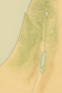
 A gentle, gradient-based map of ancient Israel. Smooth transitions between elevation zones using desaturated greens, ochres, and blues. Minimal contouring and no outlines—just color flow.
Muted Gradient Terrain Flow
 A map where the brushstroke direction mirrors natural landforms — river valleys painted in long smooth pulls, mountain ridges in jagged sharp angles — the hand’s motion echoing the land’s memory.
Thick Brushstroke Flow Map
 A conceptual map where lush river valleys and fertile zones are made from pressed, dried flowers and leaves — the rest of the desert and hill country left as simple handmade paper textures.
Pressed Flower Terrain Map
 A detailed, decorative map where every mountain and river is outlined and lightly painted in soft jewel tones — flattened perspective, highly patterned seas, intricate and vibrant but map-faithful.
Ottoman Miniature Terrain Painting
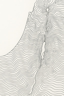
 A flat, 2D map where the entire terrain is built from repeating contour lines like a topographic "wave pattern." No elevation shading — only rhythmically spaced lines showing rise and fall.
Flat Topographic Linewave Map
 A soft-focus map where the land ever-so-gently lightens or darkens with elevation — as if seen through atmospheric haze — no sharp edges, almost dreamlike clarity. Use realistic colors.
Horizon Fade Relief Map
 A trend-aware map using soft metallic sheens (brushed silver, bronze, rose gold) subtly embedded into pastel landforms — terrain features catch glints of light without losing earthy realism.
Metallic Pastel Physical Map
 A map where mountain ridges and river valleys look like stretched muscles and tendons — taut organic lines pulling across the land, creating a powerful sense of movement and strength.
Muscle-Thread Terrain Map
 A horizontal-line map where rivers are suggested by subtle breaks in the lines — thin gaps where water cuts through the landscape — the land stitched together by flow and fracture.
Broken Line River Cut Map
 An abstract map where the land is rendered like a circuit board: rivers become silver traces, mountains are textured panels. Cool metallic palette, logical and precise.
Circuit Board Map
 A formal terrain map using slightly stylized pictorial shading — mountains with soft painted textures, valleys and plains clearly distinct, sea areas subtly textured with wave patterns.
Pictorial Terrain Guide Map
 A daringly minimal map where a single wide, textured brushstroke suggests a mountain spine, another thinner curve suggests a river valley — radical economy of means, high emotional power.
Single-Stroke Abstract Land Map
 A highly detailed texture-focused map emphasizing microterrain—small ridges, valleys, riverbeds—captured almost photographically, but with a consistent minimalist palette (like grays and muted ochres).
Microtopography Texture Map
 A smooth, undulating terrain map where color transitions are liquid and organic — modern chromatic blends (teal–mauve–sand–rose) that breathe across the landforms, with contour shifts implied by flow rather than line. Maintain landform features as much as practical, especially Mount Carmel, the Dead Sea, and the Sea of Galilee.
Liquid Gradient Morph Map
 A hyper-detailed 3D render where the sun is low on the horizon — mountains catching soft golden light, valleys sinking into deep blue shadow — dramatic yet natural, every curve richly revealed.
Golden Hour Terrain Render
 A rounded, slightly isometric map where ancient Israel looks like a floating mini-globe — hills pop up in bubbles, rivers arc around them — like a cute handheld model of the real terrain.
Mini-World Bubble Map
 A map mimicking ancient papyrus textures and tones, but enhanced with subtle modern digital glow effects—elevation lines pulse faintly, rivers shimmer. A marriage of old-world and sci-fi aesthetics. Suggest land over with color.
Ancient Papyrus Reimagined with Digital Glow
 A restrained 3D render using muted earth tones — olive greens, warm browns, pale sands — precise ridges and valleys shaped by light and shadow rather than intense color — subtle and sophisticated.
Minimalistic Earth Tone Terrain
 A map where land is divided into broad flowing curved bands — almost like stylized elevation bands — designed to mirror the pull of rivers, slopes, and coastlines without literal shading.
Segmented Flow Terrain Map
 A dreamlike map where terrain zones glow and fade like aurora lights — deserts pulse in sandy gold, river valleys shimmer green, rocky regions hum with deep cobalt — atmospheric and kinetic.
Aurora Field Map
 A minimalist but physical map focusing on the central ridge spine of Israel — tight, repetitive lines showing every ridge and valley, like the vertebrae of the land’s body.
Ridge-and-Valley Spine Map
 A map built from overlapping textures — rougher weave textures for deserts, tighter smoother textures for valleys, looser open meshes for coastlines — geography revealed by surface feel rather than drawn forms.
Texture Weave Land Map
 A lush, intricate map where terrain forms are edged and adorned with floral, flowing designs — golden rivers, hills in patterned emeralds and sapphires, a landscape of shimmering elegance.
Persian Illumination Topographic Map
 A luminous, translucent map where rivers, valleys, and hills are formed by stacked layers of frosted and clear glass — glowing softly, changing with the angle of light — terrain made liquid and luminous.
Glass Layered Relief Map
 A lightly tiled map where the land is divided into flowing but very low-contrast geometric zones — rivers and coasts respected, but everything designed on an invisible grid for easy snapping of future data points.
Soft Geometric Tile Base Map
 A gritty, high-contrast charcoal map with bold strokes and ashy textures. Mountains are smudged with depth, valleys scraped with grain. Feels like an artist dragged the terrain from stone.
Charcoal & Ash Terrain Etching
 A map of ancient Israel drawn with crisp Art Deco styling—streamlined coastlines, geometric hills, bold sunburst shading behind mountains. Muted metallic color palette: gold, bronze, deep blue.
Art Deco Terrain Map
 A terrain map where each elevation zone looks like a thin translucent vellum layer stacked atop the next, creating a delicate topographic sculpture in soft colors that preserve the landcover.
Layered Vellum Cutout Map
 A dreamy, colorful map where the terrain melts together in soft pastel fields — rivers glowing slightly brighter blue, hills brushed in warm ochres and reds — textured but luminous.
Soft Pastel Horizon Map
 A map created from coarse, earthy pigments mixed into paint pastes — rusty ochres for deserts, gritty green for hills, silty blue for rivers — every stroke textured, granular, handmade.
Natural Pigment Paste Map
 A physical map where terrain is revealed as if covered by drifting sands — dunes accumulate differently depending on elevation, making hills and valleys visible through the natural patterns.
Windblown Sand Terrain Map
 A stark modern map where the land is pure white and only the coastlines, rivers, and lakes are rendered as thin black strokes or shaded areas. Bold and airy, heavy use of negative space.
Negative Space Coastal Map
 A map where gesso (thick priming paste) is built up into low mountains, flowing valleys, soft plains — then overpainted with thin color washes that catch only the texture — land emerging through relief and subtle color.
Gesso Layer Land Map
 A map where paint is mixed with real fine sand — roughness increasing in desert zones, smoothing out by rivers — allowing texture density to feel the geography, not just see it.
Sand-Infused Paint Terrain Map
 A texture-focused terrain map of ancient Israel on a papyrus-style background. Faint topography in desaturated brown inks, as if etched or burned into aged parchment. No modern elements.
Ancient Papyrus Terrain Texture
 A traditional shaded relief map of ancient Israel, but with a warm “golden hour” sunlight effect — soft, angled light casting long, natural shadows across mountains and valleys. Vibrant yet realistic colors.
Sunlit Relief Map
 A playful but sophisticated map where geometric shapes — squiggles for rivers, bold triangles for mountains, polka-dot deserts — are overlaid with mid-century-modern color pops (mustard, teal, coral, black) against a clean field.
Neo-Memphis Geoland Map
 Inspired by stained glass: each landform rendered as a slightly beveled, colored glass pane. Mountains in deep emerald, plains in sandy yellows, water in translucent azure. Light-reflecting and bold.
Glass Mosaic Terrain Map
 A stark black-and-white relief map — no unnecessary shading — just sharply rendered valleys and ridges, relying on shadow play for topographic depth. Looks like a high-end art print more than a traditional map. Use color sparingly to indicate water. Add additional naturalistic color.
High-Contrast Relief Map
 A naturalistic map using only muted ochres, olive greens, dusty blues, and soft browns. Smooth terrain shading, subtle elevation. Modern and understated but deeply geographic.
Muted Earth Palette Terrain Map
 A map where broad ecological zones (desert, valley, hills) are gently indicated with ultra-soft fields of color — desaturated earth tones — with no visible line boundaries.
Soft Tone Landcover Zone Map
 A loose, impressionistic landscape where terrain forms are recognizable but rendered with lush, thick strokes of color — brushwork that evokes the land’s life and motion rather than drawing every feature precisely.
Painter’s Impression Map
 A conceptual map where the landmass is subtly broken into floating, slightly separated blocks, showing slight gaps where different terrains meet: coastal plan, Shephelah, hill country, rift valley, and Transjordan. Still unified, but with light tension and movement.
Deconstructed Terrain Blocks
 A color-based terrain map where warm colors flood sunlit slopes and cool colors fill shadowed valleys — simulating how real light and atmosphere would shape perception.
Lightfall and Shadow Play Map
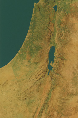
 A detailed full-color physical map focused on geography only — land elevation by color gradient, no political features, precise coastlines, clean rivers, shaded mountains, ocean bathymetry.
Atlas-Grade Physical Map
 A map where all terrain forms are rendered with sharp, perfect-edged color shapes — deserts, valleys, rivers, coasts — highly geometric, no gradients, just layered flat fields of color arranged into the real land.
Hard-Edge Abstract Land Map
 A gentle, cozy map made from layered felt — tan deserts, sage green valleys, indigo rivers — each landform a raised, plush tactile zone stitched lightly into the land's outline.
Soft Felt Terrain Map
 A clean, realistic shaded relief map of ancient Israel — soft natural terrain colors, hillshading, delicate rivers, subtle textures. Looks like a high-end U.S. National Park brochure map.
National Park Service-Style Shaded Relief Map
 A horizontal-line map where the density and slight warping of lines create the feel of woodgrain — valleys as smooth wide flows, hills as tight knot-like grain spirals.
Woven Grain Landform Map
 A heavy, shining map where mountains and ridges rise from darkened bronze or iron — rivers thin silver threads across hammered metal textures — weighty, monumental, luminous.
Cast Metal Topography Map
 A cool-to-warm gradient map where lush areas shimmer with a cool dewlike gloss, while deserts pulse with warm dusty textures — evoking the sensory shift between moisture and dryness without literal detail.
Dew and Dust Terrain Map
 A modern take: a map where sandblasting erodes shallow terrain features into glass — rivers traced deeper, mountains subtly resisted — a wind-carved landform impression.
Sandblasted Topography Map
 A map where mountains and valleys are sharply etched with high-contrast shading — ridges pop forward, valleys plunge back — giving the land a sculpted, almost carved-stone feel.
High-Relief Carved Terrain Map
 A dynamic map where the land is shown as folded planes — mountains rising at sharp origami-like angles, valleys sunken like creases — visualizing the hidden tectonic energy that shaped the surface.
Tectonic Fold Map
 A traditional terrain map style but inverted—white rivers and coasts on black land, mountains glowing with soft white edges. Striking negative-space look while keeping full landform detail.
Monochrome Inverted Map
 A trend-aware map using soft metallic sheens (brushed silver, bronze, rose gold) subtly embedded into pastel landforms — terrain features catch glints of light without losing earthy realism.
Metallic Pastel Physical Map
 A watercolor-textured map where hills puff up like cushions, rivers weave like soft blue ribbons, deserts glow golden — soft outlines, gentle shadows — fitting for an animated fairytale opening scene.
Hand-Painted Storybook Map
 A map where different parts of the land are lit as if at different times of day — morning glow in eastern valleys, noon heat over central hills, evening coolness by the sea — creating a flowing, color-rich time illusion.
Time of Day Light Map
 A map created by scattering and brushing loose earth pigments — ochres, rusts, sands — to form flowing land shapes, rivers glinting through the fine powder — evanescent and alive.
Pigment Dust Terrain Map
 A stark black-and-white relief map — no unnecessary shading — just sharply rendered valleys and ridges, relying on shadow play for topographic depth. Looks like a high-end art print more than a traditional map. Use color sparingly to indicate water.
High-Contrast Relief Map
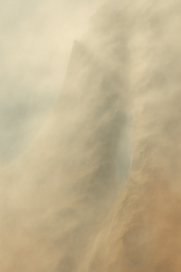
 A map where the terrain is visualized not by static form but by how winds and airflows would move across it — deserts breathless and still, mountains swirling with turbulent gusts.
Wind as Topography
 A map where the land looks like it was shaped from wet clay and left to dry — rough textures in the mountains, smooth surfaces in the valleys. Earthy, hand-crafted realism.
Tactile Clay Relief Map
 A dynamic map where dense cross-hatched brushstrokes — almost like woven fibers — build up mountains and hills, with softer open fields for valleys and river basins.
Thick Brush Weave Map
 A striking black-and-white line sketch map with ultra-minimal ink outlines and selective intense color bursts — maybe only rivers or coastal edges glow in hot colors like neon cyan — editorial sharpness meets landform respect.
Minimal High-Contrast Terrain Sketch Map
 A map where relief is entirely shown through soft gradient changes — no surface texture at all — the land shaped only by pure light and form, hyper-clean and contemporary.
Textureless Sculptural Relief Map
 A conceptual, soft-focus terrain map where mountains and valleys gently emerge from layers of mist. Faded earth tones, blurred contours, highly atmospheric but still map-accurate.
Soft Mist Terrain Map
 A lightweight, ultra-precise 3D-printed map — thin shells build mountain ridges and river valleys — hollow inside but perfectly capturing the external shape — clean layers, smooth finishes, designed for the modern hand.
3D Printed Topography Shell Map
 A flowing map where the terrain folds and bunches like a loose sheet — mountains as sharp peaks in the cloth, valleys where it dips and ripples — soft, kinetic, sculptural.
Fabric Drape Terrain Map
 A map where rivers, hills, and valleys are painted in loose, fluid acrylic or ink flows. Abstract and expressive, but the topography subtly emerges from the brushwork and color layering. The coloring should match the landcover; the desert areas should especially be desert-colored.
Fluid Terrain Painting
 Isometric view of a satellite view of the geography and landcover of all of Israel. Don't include any human features like roads, cities, or agriculture. Just show the natural landscape. Make the colors look like a realistic satellite photo, but also make it look like a videogame isometric style. Don't go for too much detail.
Isometric Satellite View